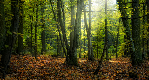
Google keeps track of forest decimation on Earth.
Google Earth’s contribution to human navigation is astounding, no doubt, but it may have contributed more to science. A new high-resolution map of the loss and gain of the world’s forests was created through the help of Google Earth.
This interactive tool charts the canopies of all the trees from 2000 to 2012. The tool is available to the public and has a remarkably high level of detail at a resolution of 30m. The forest map is based on 650,000 images taken by the Landsat 7 satellite.
“This is the first map of forest change that is globally consistent and locally relevant,” said Matthew Hansen, a professor at the University of Maryland, who led the project team that developed the map.
“What would have taken a single computer 15 years to perform was completed in a matter of days using Google Earth Engine computing.”
The interactive map shows that during those years, the Earth had lost over 1.4 million square miles of tree cover, enough trees to cover the United Kingdom six times over. The major reasons for this forest loss includes logging, fire, storms or disease.
The map showed a growth in canopy cover over Brazil as a result of their work against deforestation. According to the analysis, Brazil has improved the most of all the countries working to curb the deforestation. They cut their annual forest loss in half between the years 2003-2004 and again in 2010-2011.
However, that environmental success was negated by the increased deforestation in Malaysia, Angola, Paraguay and Indonesia, according to a study published in the journal Science. Indonesia was the worst, more than doubling its annual forest loss in 2011-2012 to nearly 13,000 square miles per year.
The United States has a four times the rate of disturbance in its southeastern forests than the rain forests in South America. What this means is that 31 percent of America’s forest cover was either lost or regrown.
Calculating the gains and losses, and the result was still an overall loss of nearly a million square miles per year.
The interactive map will be updated every year and has the potential for monitoring the efficacy of forest management programs as well as the impacts of deforestation—including carbon storage, biodiversity and climate change.
“This new monitoring approach can for the first time provide – on a global scale – transparent accountability for monitoring progress toward achieving real declines in deforestation,” said Daniel Zarin, member of the Climate and Land Use Alliance.
is a